Severe Weather Coordination Message #1 – Monday July 23rd, 2012 Severe Weather Potential

Hello to all..

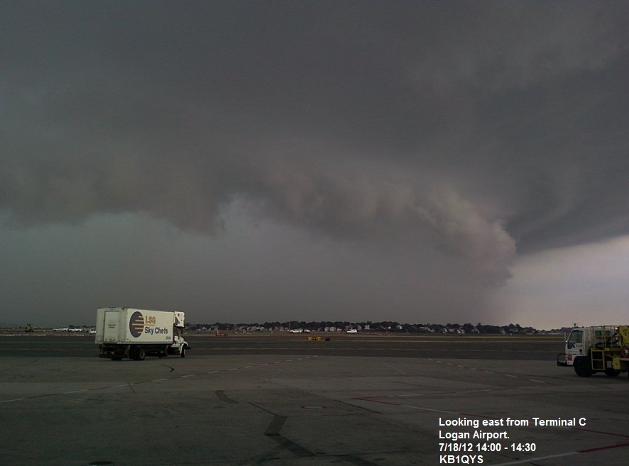
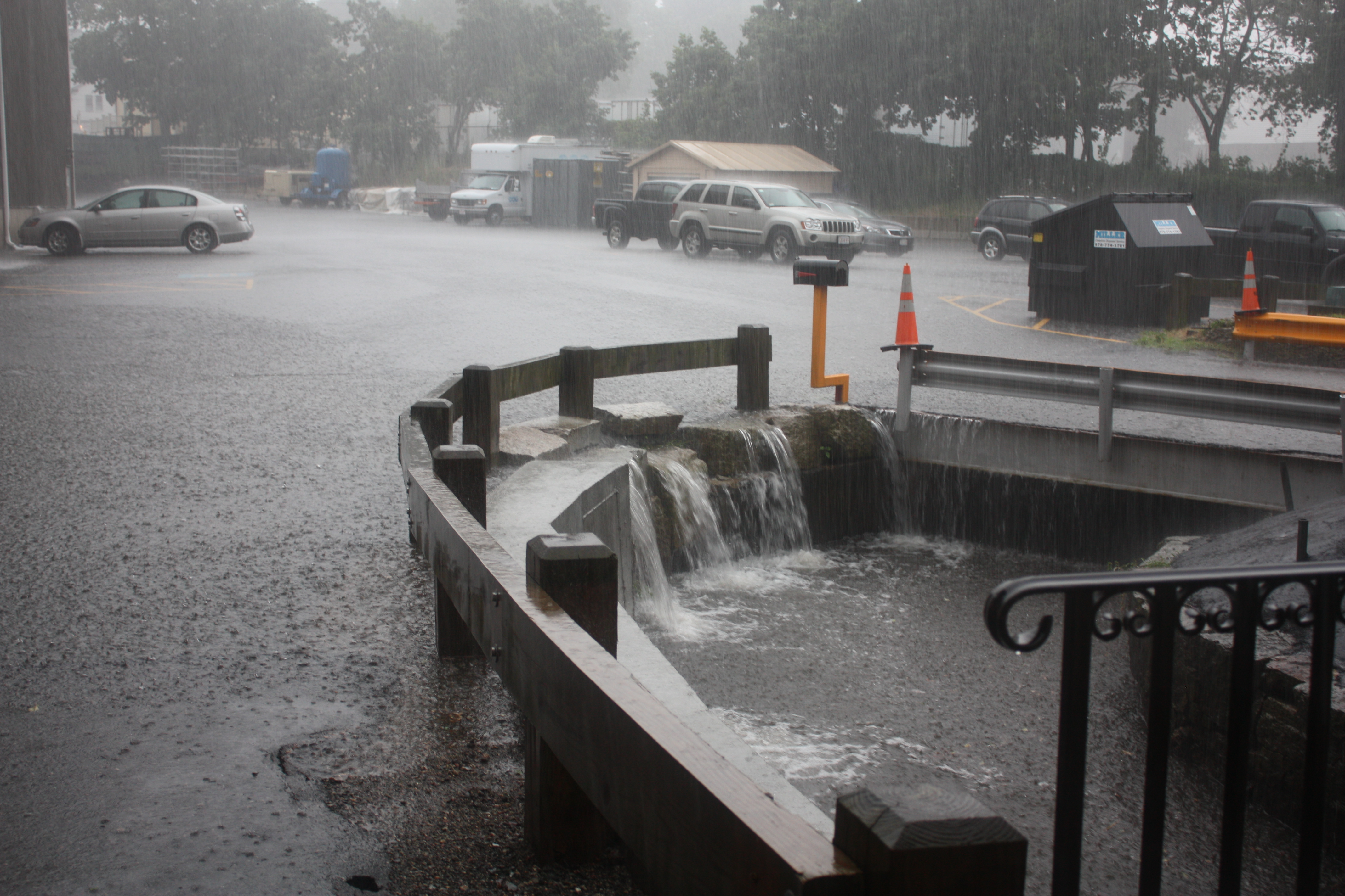
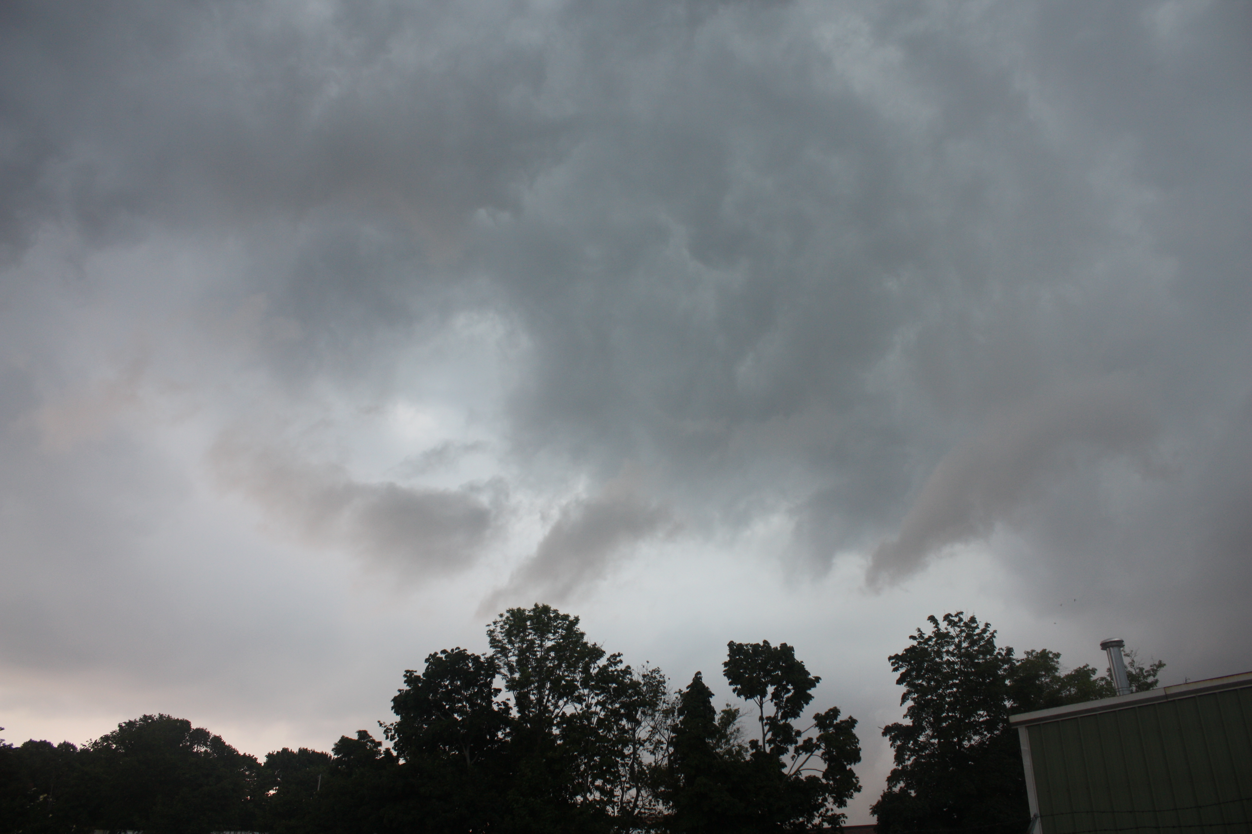
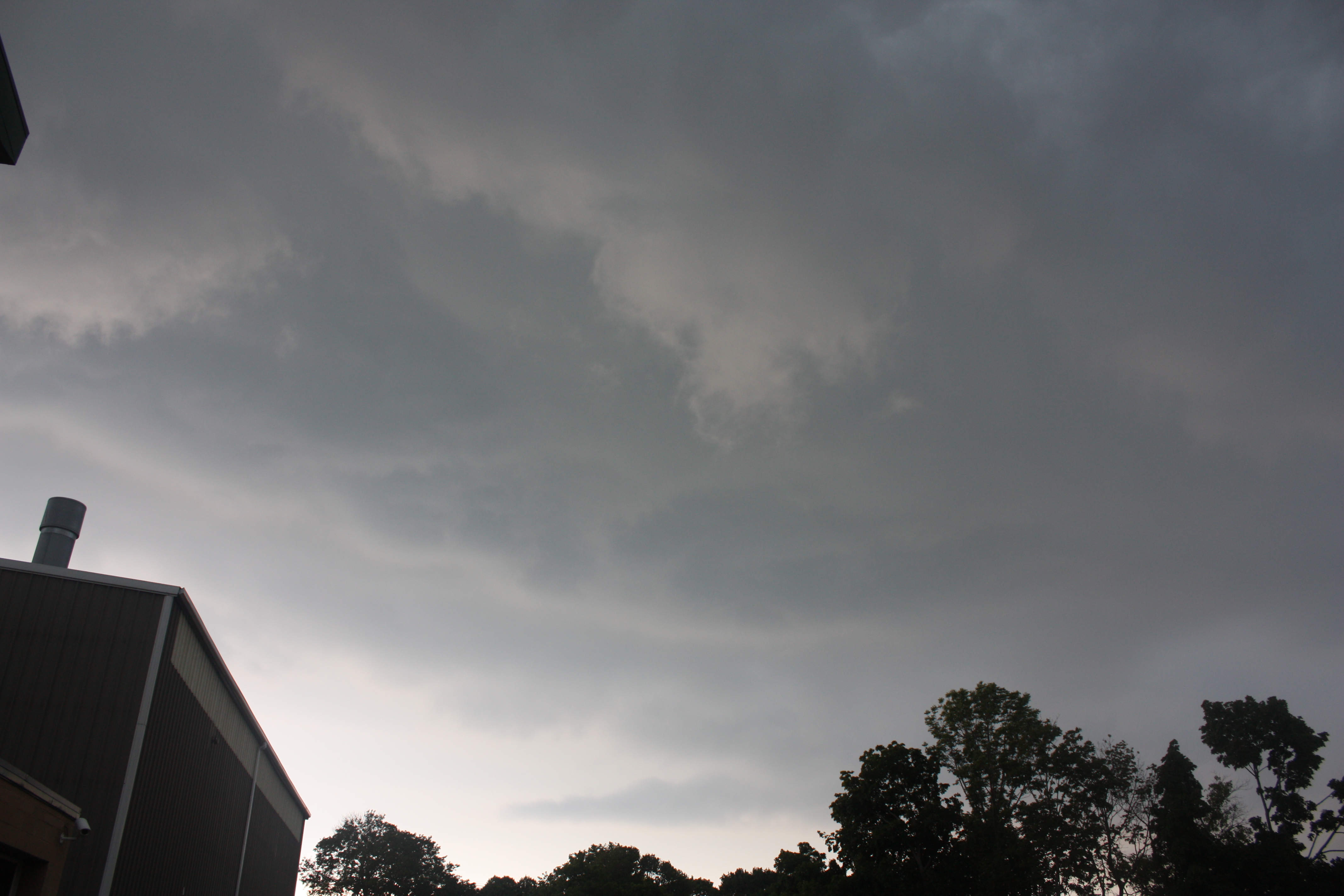
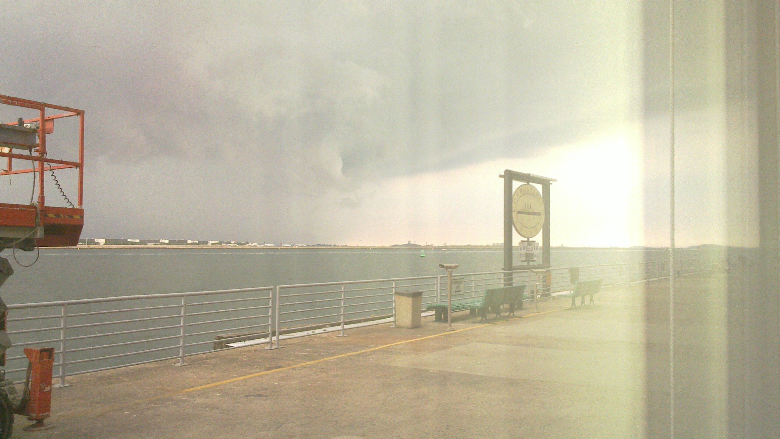
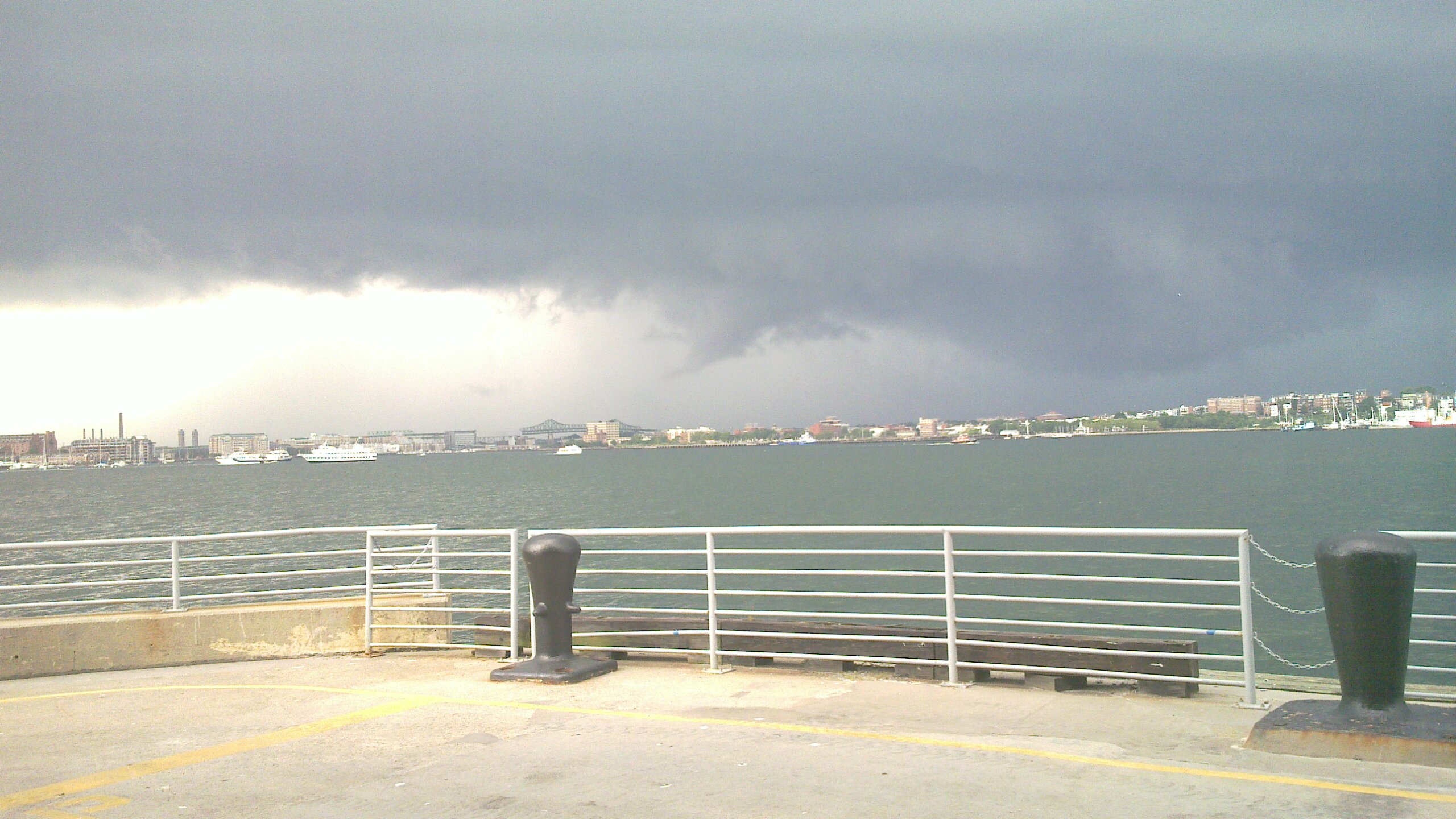
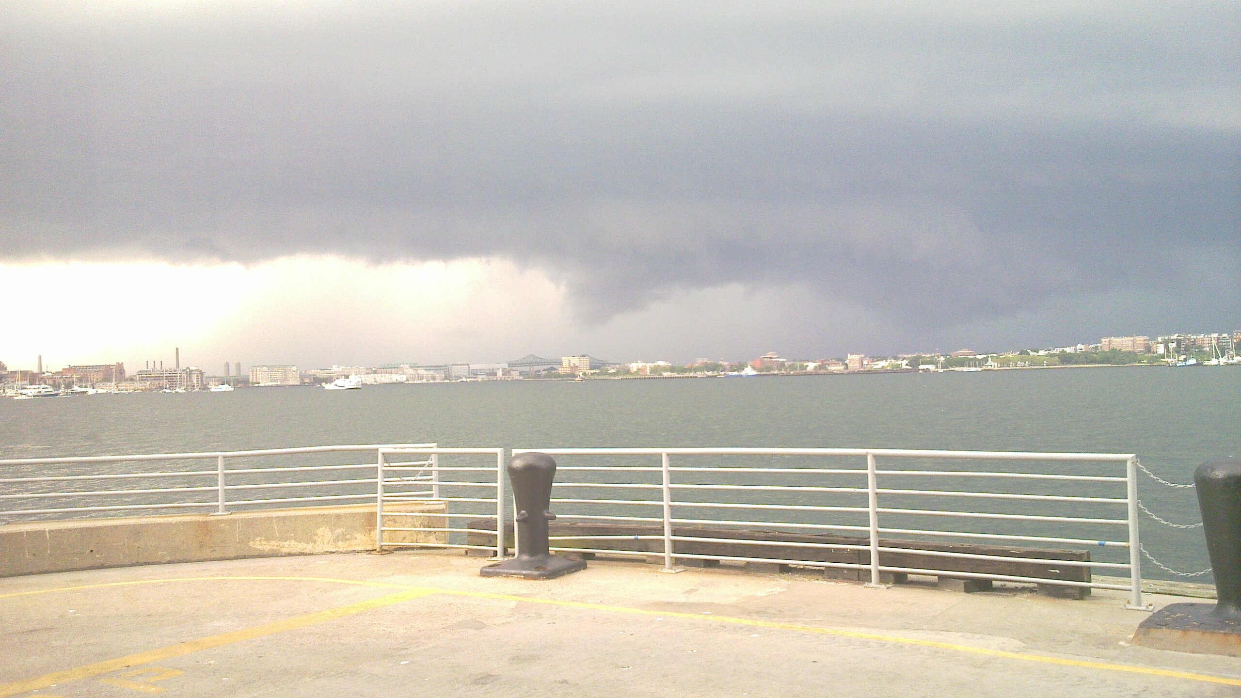
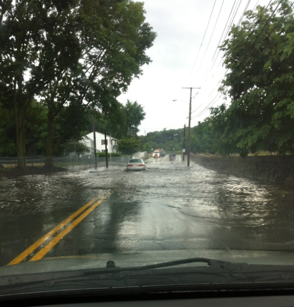
..Isolated to Scattered Strong to Severe Thunderstorms are possible over Interior Southern New England on Monday. Damaging winds, large hail and urban and poor drainage flooding are the primary threats..
..The Storm Prediction Center (SPC) has 5% probabilities of severe weather over much of Southern and Eastern New England with a Slight Risk for severe weather over Western, Northern New York, most of Vermont, Northern New Hampshire and Western Maine and NWS Taunton is in agreement..
..An additional potential for severe weather exists for Tuesday and will be covered in future coordination messages after the Monday Severe Weather Potential has passed..
..SKYWARN Activation with Ops at NWS Taunton are possible on Monday Afternoon and Evening and again on Tuesday Afternoon and evening..

A warm front will move through the region overnight. After that passes through the region, a trough will develop over portions of New York and New England as the heat and humidity increase. The trough maybe close enough to Southern New England for isolated to scattered strong to severe thunderstorms with damaging winds, large hail, and urban and poor drainage flooding as the primary threats. The threat timeframe will be during Monday Afternoon and evening. Low severe weather probabilities have been introduced by SPC for much of Southern New England with a Slight risk for severe weather over Western and Northern New York, most of Vermont, Northern New Hampshire and extreme Western Maine. The proximity of the front, cloud cover, and wind shear over the area will determine the risk for severe weather for Monday Afternoon and Evening.

There is also the potential for severe weather on Tuesday. This will depend on the timing of the cold front over the area as well as wind shear and cloud cover over the region similar to Monday. This will be discussed in greater detail after the Monday severe weather potential has passed.

SKYWARN Activation with Ops at NWS Taunton are possible Monday Afternoon and Evening. Another coordination message will be issued by 830 AM Monday Morning. Below is the NWS Taunton Hazardous Weather Outlook and SPC Day-2 Convective Outlook:

NWS Taunton Hazardous Weather Outlook:
http://kamala.cod.edu/ma/latest.flus41.KBOX.html

SPC Day-2 Convective Outlook:
http://kamala.cod.edu/offs/KWNS/1207221732.acus02.html

Respectfully Submitted,

Robert Macedo (KD1CY)
ARES SKYWARN Coordinator
Eastern Massachusetts ARES Section Emergency Coordinator
Home Phone #: (508) 994-1875 (After 6 PM)
Home/Data #: (508) 997-4503 (After 6 PM)
Work Phone #: 508-346-2929 (8 AM-5 PM)
Email Address: rmacedo@rcn.com
http://ares.ema.arrl.org
http://beta.wx1box.org

Read more

NWS Taunton Public Information Statements – Hurricane Preparedness Week Monday 7/16/12-Friday 7/20/12

Hello to all..

NWS Taunton declared this past week from Monday 7/16/12-Friday 7/20/12 as Hurricane Preparedness Week. NWS Taunton issued Public Information Statements for Hurricane Preparedness Week over the past week. The link below contains those NWS Taunton Public Information Statements:

http://beta.wx1box.org/local/hurricane_prepare_week_2012.txt

Respectfully Submitted,

Robert Macedo (KD1CY)
ARES SKYWARN Coordinator
Eastern Massachusetts ARES Section Emergency Coordinator
Home Phone #: (508) 994-1875 (After 6 PM)
Home/Data #: (508) 997-4503 (After 6 PM)
Work Phone #: 508-346-2929 (8 AM-5 PM)
Email Address: rmacedo@rcn.com
http://ares.ema.arrl.org
http://beta.wx1box.org

Read more

Post Severe Weather Coordination Message – Wednesday July 18th, 2012 Severe Weather Outbreak

Hello to all..

..Largest Severe Weather Outbreak of the 2012 Summer Season to date affected much of the NWS Taunton County Warning Area from Connecticut to Rhode Island to South-Central and Eastern Massachusetts..
..Additional Pictures have been received and links to those pictures are provided below..
..NWS Taunton issued a Public Information Statement officially declaring a microburst in Arlington, Massachusetts. That statement and listings to the raw storm report log and Local Storm Report as well as additional pictures are listed below. This will be the last post severe weather message on this event..

NWS Taunton Local Storm Report Log:
http://beta.wx1box.org/local/lsr_7_18_12.txt

NWS Taunton Public Information Statement on Arlington Microburst:
http://beta.wx1box.org/local/pns_7_18_12_arlington.txt

Raw Storm Report Log:
http://beta.wx1box.org/local/storm_reports_7_18_12.txt

Arlington Mass Complete Microburst Photo Album:
http://kb1ncg.shutterfly.com/1480

Chandler Road – Medford, Mass Large Limb Down Picture provided by Hal Bloom:
http://beta.wx1box.org/local/large_limb_down_chandler_road_medford_hal_bloom.jpg

1.25-1.50″ Hail in Southbridge, Mass Picture provided by Dan Butler:
http://beta.wx1box.org/local/HAIL_Southbridge_dan_butler.jpg

KB1QYS-Paul Nichols (Shelf Cloud Picture from Logan Airport):
http://beta.wx1box.org/local/genimage_kb1qys.jpg

Arlington Mass Microburst Pictures by KB1NCG-Marek Kozubal and KB1USO-Kate Murphy:
http://www.facebook.com/wx1box (Photo Album posted)

KB1KQW-Jim Palmer Half Dollar Hail and Funnel Cloud – Peabody, Mass:
http://beta.wx1box.org/local/IMG_0811_jim_palmer_kb1kqw_half_dollar_hail.JPG
http://beta.wx1box.org/local/IMG_0804_funnel_cloud_peabody.JPG
http://beta.wx1box.org/local/IMG_0817_flooding_foster_street_peabody.JPG
http://beta.wx1box.org/local/IMG_0815_flooding_foster_street_Peabody.JPG
http://beta.wx1box.org/local/IMG_0813_flooding_foster_street_peabody.JPG
http://beta.wx1box.org/local/IMG_0812_flooding_foster_street_peabody.JPG
http://beta.wx1box.org/local/IMG_0810_half_dollar_size_hail_peabody_mass_kb1kqw.JPG
http://beta.wx1box.org/local/IMG_0804_funnel_cloud_peabody.JPG
http://beta.wx1box.org/local/IMG_0744_peabody_funnel.JPG
http://beta.wx1box.org/local/IMG_0743_peabody-funnel.JPG
http://beta.wx1box.org/local/IMG_0742_peabody_funnel.JPG
http://beta.wx1box.org/local/IMG_0741_peabody_funnel.JPG
http://beta.wx1box.org/local/IMG_0738_peabody_funnel.JPG
http://beta.wx1box.org/local/IMG_0736_peabody_funnel.JPG

N1EVH-Mike Nasleroad Hail Pictures – Lynn Mass:
http://beta.wx1box.org/local/IMG_1381_n1evh_mike_naselroad.jpg
http://beta.wx1box.org/local/IMG_1385_n1evh_mike_naselroad.jpg

N1VUX-Bill Ricker Boston Mass Funnel Cloud Taken at WTC Looking toward Deer Island etc.:
http://beta.wx1box.org/local/20120718_003_boston_n1vux.jpg
http://beta.wx1box.org/local/20120718_003-enhanced_n1vux.jpg
http://beta.wx1box.org/local/20120718_002-enhanced.jpg
http://beta.wx1box.org/local/20120718_002.jpg
http://beta.wx1box.org/local/20120718_001-enhanced_possible_funnel_n1vux.jpg
http://beta.wx1box.org/local/20120718_001_possible_funnel_boston_wtc.jpg

Ken Spencer Hail Picture from Saugus, Mass:
http://beta.wx1box.org/local/AyGvPnkCcAAotnW_keith_spencer_saugus_mass.jpg

Amanda Henderson Funnel Cloud Boston, Mass. Picture:
http://beta.wx1box.org/local/genimage_amanda_anderson_fanuel_hall_area.jpg

Joe Hegarty Malden Mass Golf Ball Sized Hail:
http://beta.wx1box.org/local/mkudc_golf_ball_hail_joe_hegarty_malden_mass.jpg

Dave Hodges Saugus Half Dollar Hail:
http://beta.wx1box.org/local/saugus_dave_hodges.jpg

W1PMA-John Mauro Framingham Mass 3/4″ hail on Mass Pike:
http://beta.wx1box.org/local/3_4_inch_hail_john_mauro.jpg

Paul Bilodeau 1″ hail Picture:
http://beta.wx1box.org/local/paul_bilodeau_hail_swampscott_mass.jpg

Terry Holt – Arlington, Mass Damage picture:
http://beta.wx1box.org/local/DSC_0018_terry_holt_arlington_mass.jpg

KB1VWZ-Noah Goldstein Newton Mass Flood Picture:
http://beta.wx1box.org/local/Pictures_street_flooding_beacon_st_newton_mass_noah_goldstien_kb1vwz.zip

KA1RSY-Ed Caron Hatch Street New Bedford Mass Wind Damage:
http://beta.wx1box.org/local/IMG-20120718-WA0008_ka1rsy_nb_ma.jpg
http://beta.wx1box.org/local/IMG-20120718-WA0006_ka1rsy_hatch_street_new_bedford.jpg

W1RJC-Rick Cabral – New Bedford Mass. Wind Damage:
http://beta.wx1box.org/local/imagejpeg952-w1rjc-rochaembeau-street-by-ashley-school.jpg

John Walker Linwood Street Arlington Mass Picture:
http://beta.wx1box.org/local/mass_ave_at_linwood_street_arlington_mass_john_walker.jpg

Katie Arsenault Lebanon Street Melrose Mass Picture:
http://beta.wx1box.org/local/619901517_katie_aresenault_melrose_lebanon_street.jpg

Respectfully Submitted,

Robert Macedo (KD1CY)
ARES SKYWARN Coordinator
Eastern Massachusetts ARES Section Emergency Coordinator
Home Phone #: (508) 994-1875 (After 6 PM)
Home/Data #: (508) 997-4503 (After 6 PM)
Work Phone #: 508-346-2929 (8 AM-5 PM)
Email Address: rmacedo@rcn.com
http://ares.ema.arrl.org
http://beta.wx1box.org

Read more

Severe Weather Coordination Message #3 – Wednesday 7/18/12 Severe Weather Potential

Hello to all..

..Scattered to Numerous Strong to Severe Thunderstorms likely today across much of Southern New England with the highest risk area for strong to severe thunderstorms along and south of the Mass. Pike. Damaging winds, large hail and urban and poor drainage flooding are the main threats..
..Threat timeframe will be centered anytime after Noon today lasting through tonight. The Storm Prediction Center (SPC) and NWS Taunton are in agreement on a slight risk for severe weather for today..
..SKYWARN Activation with Ops at NWS Taunton will commence at 11 AM ET today lasting through Wednesday Evening..

At 730 AM, Satellite imagery shows mostly clear skies with some high clouds in parts of Western New England. A cold front that will begin to usher in cooler and more seasonable temperatures is currently over Western Maine through South-Central New Hampshire and Vermont through Central New York and will move southeast. Overnight low temperatures were in the upper 70’s to lower 80s and with mostly clear skies, significant heating and destablization is expected. Wind shear profiles are sufficient for strong to severe thunderstorm development. Most parameters are favorable for scattered to numerous strong to severe thunderstorms today with damaging winds, large hail and urban and poor drainage flooding as the main threats. The threat timeframe for severe weather will be anytime after Noon today with the greatest threat in areas along and south of the Mass. Pike, however, all areas should monitor. SPC and NWS Taunton and surrounding NWS offices are in agreement on a slight risk for severe weather for Massachusetts, Rhode Island and Connecticut.

SKYWARN Activation with Ops at NWS Taunton will commence at 11 AM today lasting through Wednesday Evening. This will be the last coordination message on today’s threat. Below is the NWS Taunton Hazardous Weather Outlook and SPC Day-1 Convective Outlook:

NWS Taunton Hazardous Weather Outlook:
http://kamala.cod.edu/ma/latest.flus41.KBOX.html

SPC Day-1 Convective Outlook:
http://www.spc.noaa.gov/products/outlook/day1otlk.html

Respectfully Submitted,

Robert Macedo (KD1CY)
ARES SKYWARN Coordinator
Eastern Massachusetts ARES Section Emergency Coordinator
Home Phone #: (508) 994-1875 (After 6 PM)
Home/Data #: (508) 997-4503 (After 6 PM)
Work Phone #: 508-346-2929 (8 AM-5 PM)
Email Address: rmacedo@rcn.com
http://ares.ema.arrl.org
http://beta.wx1box.org

Read more

Severe Weather Coordination Message #2 – Tuesday 7/17/12 Self-Activation/Wednesday 7/18/12 Severe Weather Potential

Hello to all..

..SKYWARN is self-activated this evening for portions of Southern New Hampshire for isolated strong to severe thunderstorms that are near the area. This should gradually wane overnight..
..Scattered to Numerous Strong to Severe Thunderstorms are likely across much of Southern New England from midday Wednesday to Wednesday Evening. Damaging Winds, Large Hail, and urban/poor drainage flooding are the primary threats. The Storm Prediction Center (SPC) and NWS Taunton are in agreement on a Slight Risk for Severe Weather Across Much of Southern New England including coastal areas..
..SKYWARN Activation with Ops at NWS Taunton will commence at 11 AM Wednesday through Wednesday Evening..

The bulk of Tuesday’s severe weather occurred over Northern New England, however, an isolated severe thunderstorm snuck into Manchester, NH causing isolated damage. See the Local Storm Report below:

http://kamala.cod.edu/offs/KBOX/1207180041.nwus51.html

Wednesday has the potential to be an active severe weather day across much of Southern New England as a cold front brings an end to the latest round of heat and humidity affecting the region. There should be sufficient heating and destablization ahead of the cold front to allow for an unstable atmosphere. Wind Shear profiles also appear favorable for scattered to numerous strong to severe thunderstorms with damaging winds, large hail and urban and poor drainage flooding as the primary threats. Threat timeframe could start as early as midday Wednesday lasting through Wednesday Evening. SPC and NWS Taunton are in agreement on a slight risk for severe weather and it is noted that much of the region is in the 30% severe weather probability area.

SKYWARN Activation with Ops at NWS Taunton will commence at 11 AM lasting through Wednesday Evening. Another coordination message will be issued by 9 AM Wednesday Morning. Below is the NWS Taunton Hazardous Weather Outlook and SPC Day-2 Convective Outlook:

NWS Taunton Hazardous Weather Outlook:
http://kamala.cod.edu/ma/latest.flus41.KBOX.html

SPC Day-2 Convective Outlook:
http://kamala.cod.edu/spc/latest.acus02.KWNS.html

Respectfully Submitted,

Robert Macedo (KD1CY)
ARES SKYWARN Coordinator
Eastern Massachusetts ARES Section Emergency Coordinator
Home Phone #: (508) 994-1875 (After 6 PM)
Home/Data #: (508) 997-4503 (After 6 PM)
Work Phone #: 508-346-2929 (8 AM-5 PM)
Email Address: rmacedo@rcn.com
http://ares.ema.arrl.org
http://beta.wx1box.org

Read more

Severe Weather Coordination Message #1 – Tuesday July 17th, 2012 Severe Weather Potential

Hello to all..

..The Storm Prediction Center (SPC) has placed portions of Southern New Hampshire, Western, North-Central and Northeast Massachusetts in a Slight Risk for Severe Weather for later this Tuesday afternoon and Evening. Damaging Winds, large hail and urban/poor drainage flooding are the primary threats..
..Threat is contingent on southward extent of a disturbance that will affect portions of Northern New England and whether short-range computer models indicating much greater instability over Southern New England verify versus other reliable models indicating much less instability over the region..
..SKYWARN Activation with Ops at NWS Taunton are possible later this afternoon and evening if severe weather threat materializes in the NWS Taunton portion of the SPC Slight Risk area..

A conditional severe weather threat exists for northern portions of the NWS Taunton coverage area from Southern New Hampshire, Western, North-Central and Northeastern Massachusetts for later this afternoon and tonight as SPC has placed this region in a slight risk for severe weather with damaging winds, large hail and urban and poor drainage flooding as the primary threats. Weather models, even this close to the event, are struggling to resolve instability parameters ahead of a disturbance that will affect Northern New England with severe weather and how far south the extent of the severe weather will be. Short range reliable computer models are indicating that instability will increase allowing for severe weather in the southern portions of the area SPC has placed in Slight Risk. Other reliable computer models, however, keep the threat north of the NWS Taunton coverage area. Enough risk exists at this time to issue a severe weather coordination message covering the threat.

An additional severe weather risk exists for Wednesday for much of the NWS Taunton coverage area. This will be covered in later coordination messages Tuesday Night into Wednesday.

SKYWARN Activation with Ops at NWS Taunton are possible later this afternoon and tonight. This will be the only complete coordination message issued covering today’s threat. A shortened coordination message will be issued if time allows and Ops at NWS Taunton are initiated. Below is the NWS Taunton Hazardous Weather Outlook and SPC Day-1 Convective Outlook:

NWS Taunton Hazardous Weather Outlook:
http://kamala.cod.edu/ma/latest.flus41.KBOX.html

SPC Day-1 Convective Outlook:
http://www.spc.noaa.gov/products/outlook/day1otlk.html

Respectfully Submitted,

Robert Macedo (KD1CY)
ARES SKYWARN Coordinator
Eastern Massachusetts ARES Section Emergency Coordinator
Home Phone #: (508) 994-1875 (After 6 PM)
Home/Data #: (508) 997-4503 (After 6 PM)
Work Phone #: 508-346-2929 (8 AM-5 PM)
Email Address: rmacedo@rcn.com
http://ares.ema.arrl.org
http://beta.wx1box.org

Read more

Severe Weather Coordination Message #2 – Sunday July 15th 2012 Severe Weather Potential – Activation and Ops Starting at 3 PM ET

Hello to all..

..Isolated to Scattered Strong to Severe Thunderstorms are likely in Southwest New Hampshire, Western and Central Massachusetts and Connecticut late this afternoon and evening. These storms could reach portions of Northeast Massachusetts and Northwest Rhode Island this evening. Strong to Damaging Winds, large hail and urban/poor drainage flooding are the primary threats..
..SKYWARN Activation with Ops at NWS Taunton will commence at 3PM Sunday Afternoon..

A warm front will make its way through Southern New England this Afternoon and Evening bringing with it oppressive heat and humidity for the first half of this week. At 1130 AM, satellite imagery shows some high clouds over the area but plenty of sunshine allowing for heating and destablization. Doppler Radar at 1130 AM shows some activity in Central and Eastern New York that could gradually become better organized as it gets into Western parts of New England after 300 PM today. The unstable atmosphere combined with wind shear values should be sufficient for isolated to scattered strong to severe thunderstorms with strong to damaging winds, large hail and urban and poor drainage flooding as the primary threats. The primary threat area is over Southwest New Hampshire, Western and Central Massachusetts and Connecticut after 300 PM today but could reach portions of Northeast Massachusetts and extreme Northwest Rhode Island this evening. The Storm Prediction Center (SPC) and NWS Taunton remain in agreement on an isolated to scattered threat of strong to severe thunderstorms for Sunday Afternoon and evening.

SKYWARN Activation with Ops at NWS Taunton will commence at 3 PM this Sunday Afternoon. This will be the last coordination message on today’s threat. Below is the NWS Taunton Hazardous Weather Outlook and SPC Day-1 Convective Outlook:

NWS Taunton Hazardous Weather Outlook:
http://kamala.cod.edu/ma/latest.flus41.KBOX.html

SPC Day-1 Convective Outlook:
http://www.spc.noaa.gov/products/outlook/day1otlk.html

Respectfully Submitted,

Robert Macedo (KD1CY)
ARES SKYWARN Coordinator
Eastern Massachusetts ARES Section Emergency Coordinator
Home Phone #: (508) 994-1875 (After 6 PM)
Home/Data #: (508) 997-4503 (After 6 PM)
Work Phone #: 508-346-2929 (8 AM-5 PM)
Email Address: rmacedo@rcn.com
http://ares.ema.arrl.org
http://beta.wx1box.org

Read more

Severe Weather Coordination Message #1 – Sunday July 15th 2012 Severe Weather Potential

Hello to all..

..Isolated to Scattered Strong to Severe Thunderstorms are possible across much of Southern New England Sunday Afternoon and Evening. Strong to Damaging Winds, large hail and urban/poor drainage flooding are the primary threats..
..Threat timeframe is after 2 PM Sunday Afternoon and will be contingent on sunshine and degree of instability in the atmosphere..
..SKYWARN Activation with Ops at NWS Taunton are possible Sunday Afternoon and Evening..

A warm front will make its way through Southern New England Sunday Afternoon and Evening bringing with it oppressive heat and humidity for the first half of this week. Along the warm front, isolated to scattered strong to severe thunderstorms could organize in Eastern New York, New Jersey and Eastern Pennsylvania and make its way into Southern New England after 2 PM in western areas and after 4 PM in eastern areas with strong to damaging winds, large hail and urban/poor drainage flooding as the primary threats. The threat will be contingent on the amount of sunshine and destablization that can take place ahead of the front. Wind shear values should be sufficient for the potential for isolated to scattered strong to severe thunderstorms presuming full destablization is realized. The Storm Prediction Center (SPC) and NWS Taunton are in agreement on an isolated to scattered threat of strong to severe thunderstorms for Sunday Afternoon and evening.

SKYWARN Activation with Ops at NWS Taunton are possible Sunday Afternoon and Evening. Another coordination message will be issued by 1 PM Sunday Afternoon. Below is the NWS Taunton Hazardous Weather Outlook and SPC Day-2 Convective Outlook:

NWS Taunton Hazardous Weather Outlook:
http://kamala.cod.edu/ma/latest.flus41.KBOX.html

SPC Day-2 Convective Outlook:
http://kamala.cod.edu/offs/KWNS/1207141730.acus02.html

Respectfully Submitted,

Robert Macedo (KD1CY)
ARES SKYWARN Coordinator
Eastern Massachusetts ARES Section Emergency Coordinator
Home Phone #: (508) 994-1875 (After 6 PM)
Home/Data #: (508) 997-4503 (After 6 PM)
Work Phone #: 508-346-2929 (8 AM-5 PM)
Email Address: rmacedo@rcn.com
http://ares.ema.arrl.org
http://beta.wx1box.org

Read more

Special Announcement: ARRL to Host Webinar on Amateur Radio Response to 2012 Hurricane Season

Hello to all..

The following is a special announcement on the ARRL to Host a webinar on the Amateur Radio Response to the 2012 Hurricane Season for Tuesday July 17th, 2012 from 800-930 PM. A link to the story and the complete ARRL web story including registration instructions are listed below:

http://www.arrl.org/news/arrl-to-host-webinar-on-amateur-radio-response-to-2012-hurricane-season

The ARRL will host a webinar from 8-9:30 PM EDT Tuesday, July 17 (0000-0130 UTC Wednesday, July 18) to present information about the 2012 hurricane season and the Amateur Radio response. The program will offer presentations from representatives from the National Hurricane Center (NHC) and WX4NHC (the Amateur Radio station at the NHC), the VoIP Hurricane Net, the Hurricane Watch Net (HWN) and the ARRL. Webinar registration is open to all, but this informative web session will be of particular interest to those amateurs in hurricane-prone areas. If you are interested in emergency communications and hurricane preparedness and response, you are invited to attend this online presentation.

The following items will be included in the webinar:

•Opening remarks and introduction of presenters.

•Meteorological Overview of the Upcoming Season, presented by VoIP Hurricane Net Director of Operations and ARRL Eastern Massachusetts Section Emergency Coordinator Rob Macedo, KD1CY.

•Amateur Radio WX4NHC at the National Hurricane Center: Who We Are and What We Do and How to Contact WX4NHC and Submit Surface Reports During a Hurricane, presented by WX4NHC Assistant Coordinator Julio Ripoll, WD4R

•WX4NHC Weather Initiatives: APRS, ON-NHC, CARMEN and CWOP Programs and Equipment, presented by WX4NHC Coordinator John McHugh, K4AG

•ARRL Coordination and Interface, presented by ARRL Emergency Preparedness Manager Mike Corey, KI1U

•VoIP Hurricane Net, presented by Rob Macedo, KD1CY

•Hurricane Watch Net, presented by Hurricane Watch Net Assistant Net Manager Tom Gerard, KB3ONZ

•Q&A Session and Closing Remarks

To register for this webinar, please click:
https://www3.gotomeeting.com/register/472855454

Respectfully Submitted,

Robert Macedo (KD1CY)
ARES SKYWARN Coordinator
Eastern Massachusetts ARES Section Emergency Coordinator
Home Phone #: (508) 994-1875 (After 6 PM)
Home/Data #: (508) 997-4503 (After 6 PM)
Work Phone #: 508-346-2929 (8 AM-5 PM)
Email Address: rmacedo@rcn.com
http://ares.ema.arrl.org
http://beta.wx1box.org

Read more

Severe Weather Coordination Message #2 – Saturday July 7th, 2012 Severe Weather Potential Reduced for Much of Area – Monitoring Continues

Hello to all..

..Message delayed until after the latest 1630 UTC/1230 PM EDT SPC Day-1 Convective Outlook was issued..
..Due to Cloud cover and light showers covering portions of Southern New England not seen on weather models yesteday, the severe weather threat looks to be confined to portions of Connecticut and largely south and west of the NWS Taunton Coverage Area. A Severe Thunderstorm Watch has been issued for Litchfield, Fairfield and New Haven Counties of Connecticut until 7 PM this evening. There is the possibility that some severe weather activity could affect areas close to the watch in the NWS Taunton Coverage Area in Connecticut but this is currently a low probability..
..SKYWARN Self-Activation will monitor the progress of today’s activity. Ops at NWS Taunton now seem less likely but are possible if activity is able to organize in the northern part of a short line of thunderstorms approaching the area..
..This will be the last coordination message for today unless a significant upgrade to the situation occurs and Ops at NWS Taunton are initiated. Below is the NWS Taunton Hazardous Weather Outlook, SPC Day-1 Convective Outlook and Severe Thunderstorm Watch Information for areas just outside of the NWS Taunton Coverage Area..

NWS Taunton Hazardous Weather Outlook:
http://kamala.cod.edu/ma/latest.flus41.KBOX.html

SPC Day-1 Convective Outlook:
http://www.spc.noaa.gov/products/outlook/day1otlk.html

Severe Thunderstorm Watch #477 Statement (First Link) and County Outline (Second Link):
http://kamala.cod.edu/offs/KWNS/1207071543.wwus20.html
http://kamala.cod.edu/offs/KWNS/1207071603.wous64.html

Respectfully Submitted,

Robert Macedo (KD1CY)
ARES SKYWARN Coordinator
Eastern Massachusetts ARES Section Emergency Coordinator
Home Phone #: (508) 994-1875 (After 6 PM)
Home/Data #: (508) 997-4503 (After 6 PM)
Work Phone #: 508-346-2929 (8 AM-5 PM)
Email Address: rmacedo@rcn.com
http://ares.ema.arrl.org
http://beta.wx1box.org

Read more

1 2 3